
Littleton council to consider $500,000 Lee Gulch flood-planning agreement
The proposed agreement would fund drainage planning and flood-hazard studies across 2.66 square miles of the Lee Gulch watershed.
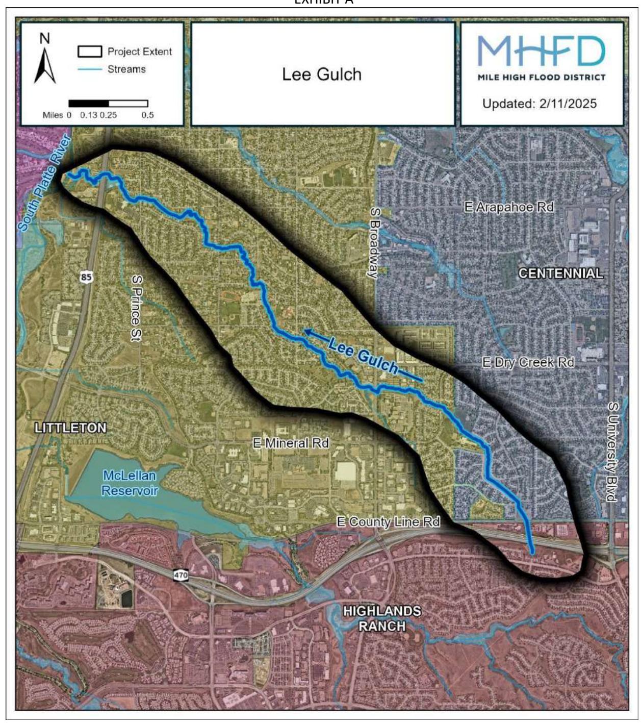
Littleton City Council is scheduled to consider a proposed $500,000 agreement with the Mile High Flood District to study drainage and flood hazards in the Lee Gulch watershed. The work could eventually inform revised floodplain maps and related development requirements.
The council is set to consider Resolution 66-2026 during its Sept. 15 meeting. The official Legistar record lists the resolution as a consent-agenda item and had no final action at reporting time.
Littleton would contribute up to $75,000, or 15% of the project cost. The Southeast Metropolitan Stormwater Authority would contribute the same amount, and the flood district would provide up to $350,000, including $150,000 for the master plan and $200,000 for flood-hazard-area delineation, according to the project agreement.
The project would cover about 2.66 square miles in the Lee Gulch and Lee Gulch South Fork basins, primarily in Arapahoe County and Littleton and Centennial. The Douglas County portion of the basin is excluded, the city staff report says.
The work would compile existing information, conduct field surveys and develop hydrologic and drainage analyses. It would evaluate options for storm sewers, channels, detention or retention basins and related facilities, considering existing and proposed land uses, known flooding and erosion, stormwater quality, wetlands, wildlife habitat, right-of-way needs and legal requirements. Deliverables would include electronic reports, schematic plans, mapping and hydrologic and hydraulic calculations.
The agreement does not set a fixed completion date. Its term ends two years after the final master-planning report is delivered and final funding is accounted for. The parties signed it in August 2025, and the staff report says work had begun after the agreement was mistakenly executed without prior council authorization. The resolution would ratify the agreement and related actions retroactive to Aug. 21, 2025.
The flood-hazard-area delineation, or FHAD, would update flood-risk information and floodplain boundaries. The staff report says the information could support a future physical map revision by the Federal Emergency Management Agency. The existing Lee Gulch FHAD dates to 1977 and is described as the current regulatory hydrology for federal mapping.
The proposal would not itself put new floodplain maps, property restrictions or federal flood-insurance requirements into effect. The Mile High Flood District explains that FHAD data may be submitted to the Federal Emergency Management Agency for a map revision, which could change mapped-risk boundaries and affect local development requirements after the applicable process. The district’s says a FHAD map alone does not trigger federal flood-insurance requirements.