
Castle Rock approves $47,346 trail flood-map study amendment
The amendment funds analysis of two upper Front Range Trail crossings for a planned McMurdo Gulch flood-map revision; staff anticipates submitting it in spring 2027.
Published at
Castle Rock Town Council approved a $47,346 amendment to add two upper Front Range Trail crossings to a planned flood-map revision for McMurdo Gulch. The council approved the consent calendar 7-0 on Oct. 20, including Resolution 2026-125, which covers the amendment, the council’s video shows.
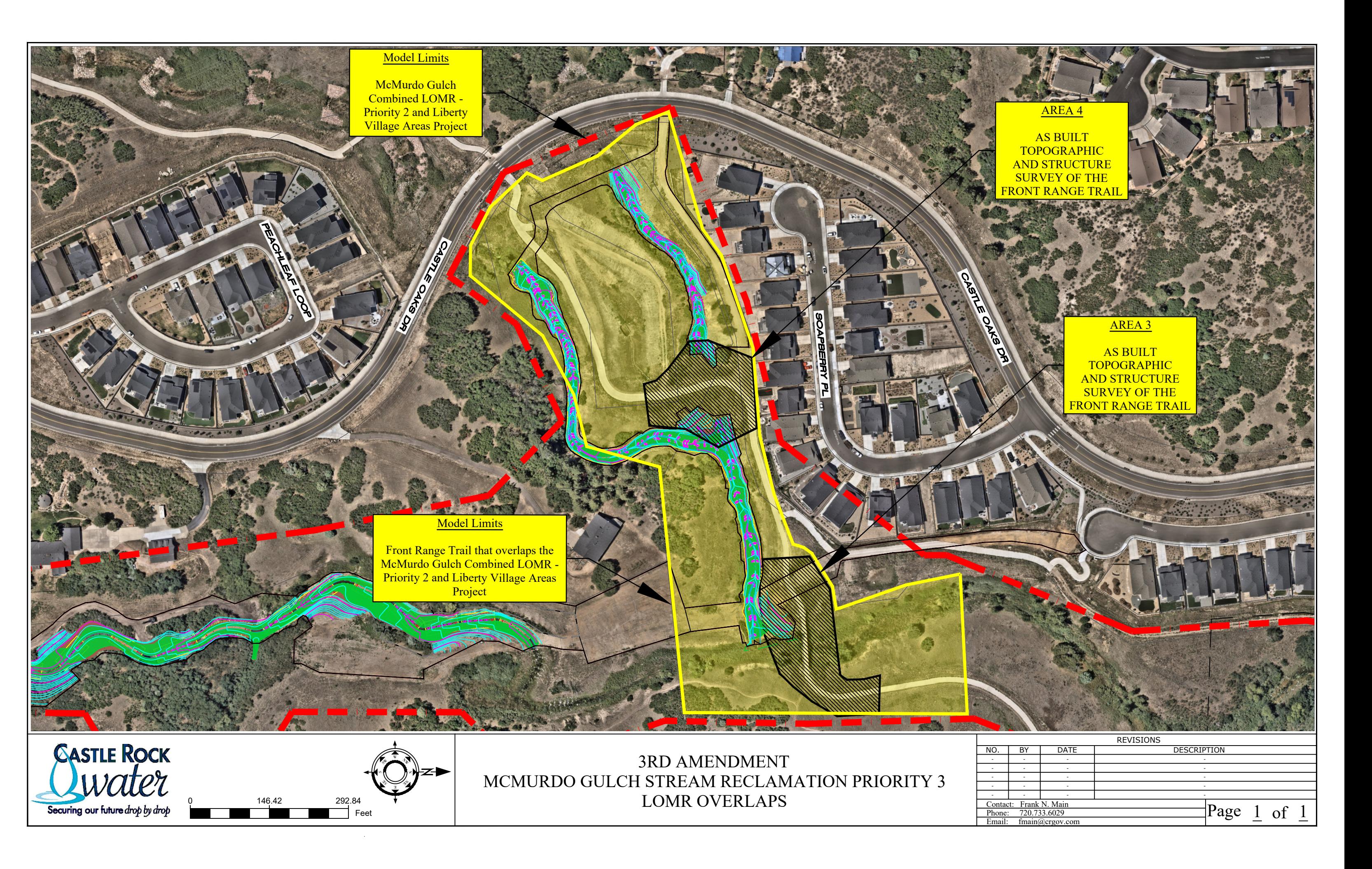
The amendment to the town’s agreement with Muller Engineering covers the upper two crossings of McMurdo Gulch and Tributary 5, identified as Areas 3 and 4 in staff’s proposal. It funds survey work, updates to hydraulic models and preparation of materials for a combined Letter of Map Revision, or LOMR, to submit to the Federal Emergency Management Agency (FEMA). The lower two crossings are being handled through a separate combined LOMR.
The amendment raises the agreement’s not-to-exceed amount from $459,173 to $506,519 and extends its term through Dec. 31, 2027. Staff’s funding plan totals $52,080.60, including a separate $4,734.60 contingency for eligible changes to the trail LOMR. The contingency would not increase Muller’s contract unless separately authorized.
Staff anticipated starting the LOMR updates in fall 2026, after construction and as-built surveys, and submitting the materials to FEMA in spring 2027. A LOMR can revise effective flood-map information, including floodplain boundaries, floodway delineations or base-flood elevations, depending on the analysis and FEMA’s decision. Federal regulations describe the revision process; the eventual determination for McMurdo Gulch will establish whether and how the maps change.
The project-specific FEMA review is separate from Douglas County’s broader Flood Risk Program with the Mile High Flood District. Program materials describe a screening-level assessment to help prioritize flood-risk-reduction projects, not a revision of FEMA’s regulatory flood maps.