
Englewood council to consider $27,400 for regional flood-risk assessment
The district would match the proposed contribution at least dollar for dollar as it assesses flood risks across about 170 watersheds through 2029.
Published at
Englewood City Council is scheduled to consider a $27,400 contribution Oct. 19 to the Mile High Flood District’s regional flood-risk assessment. The district would contribute at least as much as Englewood. The item is on the consent agenda for a first-reading vote. The proposed assessment would support regional planning, not establish floodplain boundaries or regulations; any regulatory changes would require separate city review and approval, the council communication and draft agreement say.
The district’s July 2026 implementation plan sets a target of developing baseline flood-hazard and risk information across about 170 watersheds from late 2026 through 2029. The work is intended to assess flooding under existing conditions, including risks to people and infrastructure.
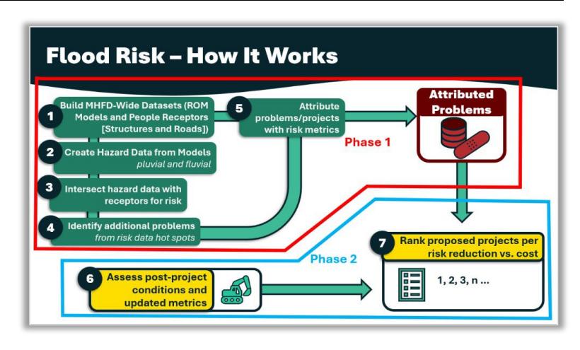
The district plans to combine modeled flood hazards with information about buildings, roads and trails to identify risk hotspots. Local governments could use the results to compare mitigation options and weigh expected risk reduction against project costs when setting capital priorities.